
Finding a La Vergne Street Record
Begin the La Vergne street directory process with the physical address, not a person’s name. The Rutherford County Property Assessor’s WebPro can search an owner name, street name, or map-and-parcel reference. A street-only search is useful when the number is unknown. WebPro accepts three or more characters, and its name example is entered as “Doe John” without a comma. Its results are assessed parcels, so a result can identify an owner and a location without proving who is currently present there.
- Normalize the street direction and suffix, then run a street-only search in Rutherford WebPro or enter the address in TPAD. Sort the results by property address and save each parcel ID.
- Open the same road segment in the Rutherford GIS Data Hub. Click parcels one at a time, noting the physical address, owner mailing fields, city and jurisdiction.
- Open the printable record card or historical-data view. Keep the situs address, mailing address, and legal description as separate facts.
- Use the deed book and page or the Register’s title-search route to read the current conveyance, then follow grantor and grantee names through earlier instruments.
- For an older address, check the verified Polk years and local-history shelves. A permitted Elections order can provide a list or label format for the allowed geography, but the public voter form is not a street browser.
That order avoids a common error. A mailing address can belong to a trust, lender, relative, post office box, or another county, while the situs address is the place on the parcel record. A homestead exemption can support an owner-occupancy claim, yet it does not identify every household member.
La Vergne Street Directory Search Fields
WebPro is the quickest way to turn a La Vergne street name into parcel results. The state’s Tennessee Property Assessment Data search adds property address, subdivision, classification, sale-date range, and parcel components. TPAD has no verified dedicated ZIP field, but its address field can narrow a property search. Preserve the punctuation in any returned parcel ID, because the combined identifier is more reliable than a street string after a tract split or a name change.
| WebPro or TPAD field | Use on a street search | Format or result |
|---|---|---|
| Search text | Enter a road, owner, or parcel lead | WebPro needs at least three characters |
| Street Name / Property Address | Find assessed parcels along a road | A number may be omitted when the road is known |
| Map & Parcel | Confirm one parcel after map review | Examples use control-map and parcel punctuation |
| Control Map, Group, Parcel | Use TPAD’s separated parcel components | TPAD keeps the three components apart |
| Sort By | Put a road’s results in address order | Owner, property address, parcel, subdivision, class, or sale date |
| Record-card actions | Inspect a selected parcel | Summary, printable card, improvements, historical data, and export controls |
The WebPro property-search surface shows the record-card and export controls used after a result is selected.
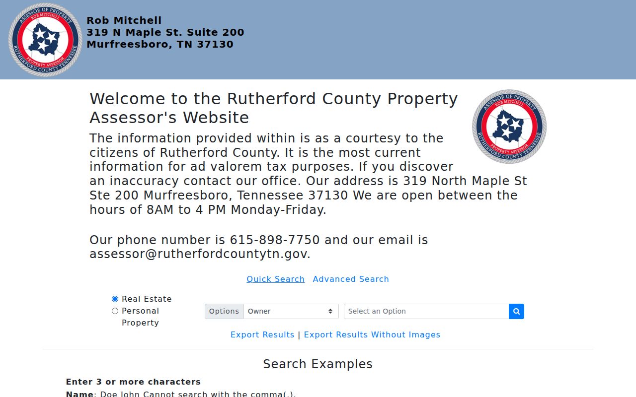
Use the detailed card to compare owner, assessed values, sale material, improvements, and deed references, rather than treating a short result row as the full property record.
The TPAD advanced-property search supplies the address, subdivision, sale-date, and parcel-component fields that complement WebPro.
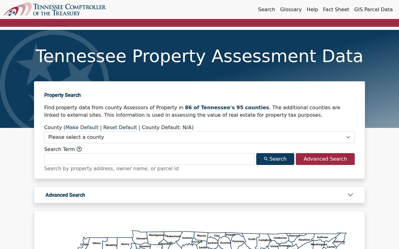
TPAD can sort a selected result set by property address, owner, parcel ID, subdivision, classification, or sale date, which helps keep a road review in a useful order.
La Vergne Street Parcels in GIS
GIS gives a street search its spatial check. Start at a known intersection, zoom to the road segment, and click the parcels in sequence. The county’s map fields can include parcel number, acreage, physical address, city, ZIP and ZIP+4, zoning, planning jurisdiction, owner mailing address, deed book and page, sale information, values, legal description, and district fields. A number range alone is not a complete block: rear lots, private drives, large tracts, and multi-unit parcels can be indexed differently.
The county GIS landing page routes to the County Map and Data Hub.
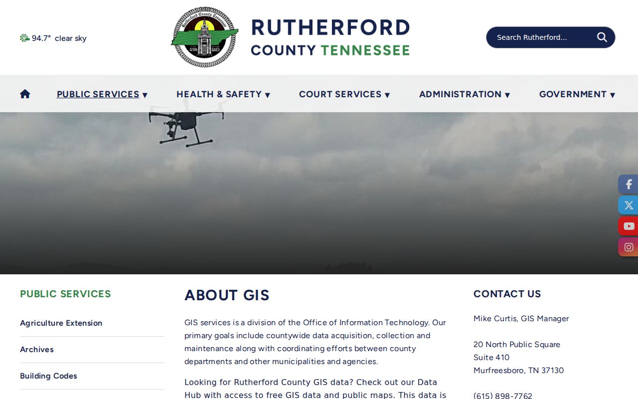
Rutherford County says the map layers are periodically refreshed, not legally binding or certified, and require independent verification. Use them to locate and compare parcels, then verify a boundary or ownership question with the assessor card, recorded deed, or plat.
Note: Record the map date, parcel-layer date if shown, and the reason each parcel was included in a street review.
La Vergne Records by Street Address
Several custodians contribute to La Vergne address research, and no one source has the same scope as another. The assessor establishes the current tax association. GIS helps place it. The Register supplies the recorded land trail, while city permits can date work at an address. Archives and directory collections can add older context. Read the access route beside each record type before assuming an online result is complete.
| Address record | Custodian | What it can show | Access route |
|---|---|---|---|
| WebPro and TPAD parcel records | Rutherford Property Assessor | Owner, mailing and situs addresses, values, exemptions, sales, improvements | Online, or the assessor counter at 319 N. Maple Street |
| County Map / GIS | Rutherford GIS and Office of Information Technology | Geometry, districts, zoning, address fields, deed references | Data Hub or County Map |
| Deeds, plats, and releases | Rutherford County Register of Deeds | Grantor, grantee, legal description, book/page, plat | US Title Search route, counter, or older TSLA and FamilySearch microfilm |
| Tax records | Trustee and County Archives | Taxpayer and parcel clues | City tax links or Archives holdings from 1877 through 2012 |
| Permits and certificates | La Vergne Codes | Applicant, work, inspections, and certificate dates | Online permit route, direct request, or city public-records request |
| Historical directories | Library, HRC, and Nashville Public Library catalog | Name, address, telephone, or business context where a volume includes it | Local shelf, research-room databases, interlibrary loan, or catalog follow-up |
The assessor is at 319 N. Maple Street, Suite 200, Murfreesboro, and lists 615-898-7750 with weekday hours of 8:00 a.m. to 4:00 p.m. The physical counter remains useful when an online export lacks a needed card or date range. County Archives, at 435 Rice Street, also offer a call, email, or in-person route for historic holdings.
La Vergne Street Deed Chains
For ownership history, begin with the current assessed owner and the deed reference on the parcel card. A deed’s grantor is the party transferring land, and its grantee is the party receiving it. Read the recording date, instrument type, legal description, lot or block, and plat reference. Then search the earlier grantor as a prior grantee. Match the legal description rather than relying only on the street name, especially where a parcel has been split, merged, or described by metes and bounds.
The Register’s title-search instructions use a TVA Map Box Y or Z, book year, and page workflow. The office at 319 N. Maple Street, Room 133, Murfreesboro, is open weekdays from 8:00 a.m. to 4:00 p.m. at 615-898-7870. Its page says the office does not guarantee clear title or act as a title-search service, so a complete title conclusion belongs with a qualified title professional.
The Register title-search screen illustrates the map, book, and page path used to reach a recorded instrument.

Rutherford’s deed books for February 1, 1853 through November 20, 1862 were lost during the Civil War. A Register’s notebook later supported an index completed May 9, 2013. Treat a gap in those years as a reconstructed-index problem, not evidence that no transfer occurred. Tennessee State Library and Archives and FamilySearch catalog material are the older-record fallback when the current online cutoff is not stated.
La Vergne Voter Records by Street
The state’s individual voter lookup verifies one person, not everyone on a road. Its form requires county, first name, last name, birth month, and birth year. It does not accept a street or ZIP search. A match may provide status and district context, but it is not historic residence proof. Inactive status can follow an address-confirmation mailing and does not itself mean a person cannot vote.
| County voter-data route | Documented choice |
|---|---|
| Individual verification | Tennessee lookup with all five identity fields |
| Electronic data | CD in DBF format, the only documented route for one to ten years of voter history, $50 |
| Printed formats | Lists at $0.02 per voter or labels at $0.25 each; standard lists may be by household |
| Geography and ordering | City ward, commission district, or all county; written order by fax or email, then payment to Elections |
The Tennessee Voter Registration Lookup shows the identity fields used for the individual route.
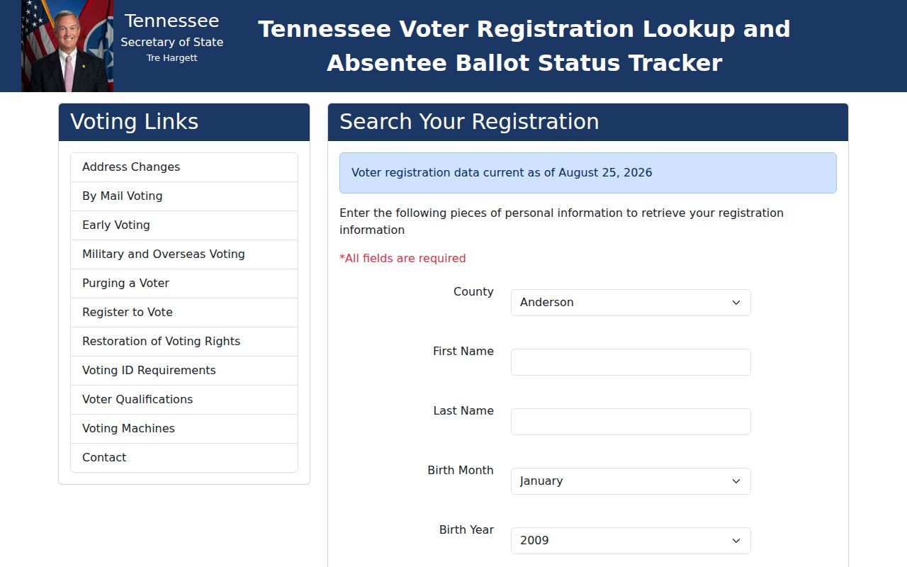
For a permitted county order, Rutherford Elections accepts written requests by fax at 615-217-7144 or by email, then calls when the material is ready. The office is at 1 S. Public Square, Suite 103, Murfreesboro, 615-898-7743, weekdays 8:00 a.m. to 4:30 p.m. No Social Security numbers are sold, and voter history records participation, never ballot choices.
La Vergne Street Permit Evidence
Addressed permit records can put dates around construction, alteration, inspection, or a certificate of occupancy. La Vergne’s process uses online permit applications, calls for inspections within 24 hours and re-inspections within 48 hours, and describes certificates of occupancy within 72 hours after final inspection. An applicant or contractor listed in a permit identifies a project role, not a statement that the person occupied the address.
Use La Vergne Codes for the current permit route. For an older file or a specific address-and-date range, use the city’s public-records portal or make a focused request to Codes. The city’s JustFOIA system offers All Records and Police Records forms. Historical public search fields and a coverage year are not documented, so request an existing permit, inspection, or certificate record rather than asking for a newly created street report.
Under the Tennessee Public Records Act, a custodian may need a description, time range, and existing record series. A county request also has inspection, on-site, mail, electronic, or other delivery choices. If a record is not promptly available, the custodian must take action within seven business days. Note: A request can seek an existing address file, but it cannot require staff to compile a custom directory.
La Vergne Street Names Over Time
Older records may call the place LaVergne, Buchananville, or Mountain View. The official name changed from one word to two in 1987. La Vergne’s late-1950s Men’s Club selected street names from members who lived near or on those roads, so early deeds and maps can use a family, tract, or road term that does not match a current label. Search each spelling and save both the source wording and the modern GIS match.
Do not assign a date to a citywide renumbering. The research found no verified La Vergne renumbering project, E911 assignment page, or full annexation-by-address map. The city’s incorporation history also has breaks: incorporation in 1860, rescission in 1881, reincorporation in 1972, and an alderman charter in 1988. Those dates explain why municipal records may not follow a simple continuous sequence.
The Polk catalog has verified regional years of 1994, 1996, 1998 through 2001, 2003, and 2005. The local reverse or criss-cross section was not verified. A criss-cross directory is an address-arranged directory, while a plat connects a street address to a subdivision lot or block. The Library of Congress confirms that city directories may be arranged by address and telephone, but the exact La Vergne reverse run needs confirmation at the library or Historical Research Center.
La Vergne Street Directory Terms
Keep these labels distinct in a La Vergne address worksheet. Each describes a different part of the record trail.
- Parcel
- A tax-map unit of land identified by a parcel number. It may cover one address, several units, or an unaddressed tract.
- Situs address
- The physical location of the parcel. It is different from the owner mailing address used for tax correspondence.
- Plat
- A recorded map that can connect a subdivision, lot, block, street, and parcel reference.
- Criss-cross directory
- An address-arranged directory. It can help trace an older address when that particular volume has a reverse section.
Limits of a La Vergne Street Directory
An address result is not a household roster. Assessor cards do not normally identify every person at the location, and unlisted household members do not become public because a parcel has an owner. Private utility-customer data, driver address data restricted by the DPPA, protected Safe at Home information, sealed matters, and juvenile details are outside this street method. Never fill a gap with an assumption from a mailing address or a neighboring parcel.
Lawful use. Use La Vergne address records for personal, lawful research such as family history, estate questions, property curiosity, or civic review. Do not use any result to stalk, harass, intimidate, or harm a person.
When sources disagree, retain the source URL, search terms, result date, parcel ID, address components, deed reference, and jurisdiction field. That small record log makes a duplicate, a split tract, or a stale map result easier to resolve with the actual custodian.